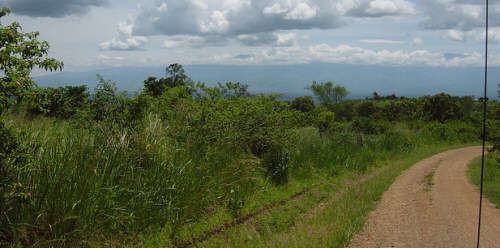
Formerly part of the Kabarole district. It became a district in 2000.
LOCATION
It borders Kyenjojo in the east, Kabarole in the west, Kibale and Kyenjojo in the north. Mbarara in the south.
POPULATION
295.313 people, 152.132 female and 143.181 male.
MAIN LANGUAGES
Rukiga, Rutagwenda and Rutooro
ECONOMIC ACTIVITIES
Agriculture with emphasis on food crops such as Sorghum, maize, finger millet, pigeons, Pease, g-nuts, sunflower, sweet potatoes and beans. Cash crops include; tea, cotton and Coffee. Vegetables and fruits include Tomatoes, Cabbages and Onions. There is fishing in Kitagwenda.
EDUCATION SERVICES
The district has a total of 132 primary schools with 116 government, 9 private and 7 community schools. For secondary schools, the district has a total of 20 schools. 6 are government schools, 4 private and 10 community.
HEALTH SERVICES
The district has 7 Government dispensaries (II), 6 health centres (III) at county, 2 health centres (IV) at sub-district but no hospital. More so, it has 3 private/NGO dispensaries, 1 health centre.
TOURIST ATTRACTIONS
Kibale Forest National Park which is rich and unique habitat for more than 250 species and over 300 bird species.

 Posted in

